
New water monitoring technology is creating global inequalities
The world’s water resources are changing rapidly. At the same time, satellites and AI are opening up entirely new possibilities for monitoring our freshwater systems.
Water shortages, floods and changing water conditions are affecting people all over the world. At the same time, new technology is creating entirely new opportunities for monitoring the world’s freshwater. However, there is a risk that technological developments could exacerbate existing inequalities. Giuliano Di Baldassarre joins researchers from several other countries in calling for fairer and more inclusive water monitoring.

Giuliano Di Baldassarre, Professor of Hydrology at the Department of Earth Sciences. Photo: Mikael Wallerstedt, Uppsala University
The world’s water resources are changing rapidly, while the need for knowledge about water is becoming ever greater. Satellites, Earth observation and artificial intelligence now make it possible to monitor water on a scale that was previously impossible.
But more data is not necessarily the solution.
“Technological developments offer us fantastic opportunities to understand how our water resources are changing. But key questions are who should have access to the data and whether we should base decisions about water solely on this large-scale data or instead factor in the knowledge held by the people who actually experience water-related problems first-hand,” says Giuliano Di Baldassarre, Professor of Hydrology at the Department of Earth Sciences, Uppsala University.
Inequalities may be exacerbated
A new article, published in Nature Water, argues that technological developments offer enormous opportunities to improve our understanding of freshwater, but that they also create new inequalities in terms of who has access to and can use water-related data and, ultimately, who benefits from it.
Satellite infrastructure, computing capacity and expertise are concentrated in a limited number of countries. The satellite data itself may be free to use, but both technical equipment and knowledge are required to utilise it. Countries with fewer resources may therefore find it more difficult to benefit from the new technology.
Developments in AI may further widen this gap. The most advanced AI models require vast amounts of computing power, which is also unevenly distributed across the globe. At the same time, many language models are trained primarily on English-language and Western-influenced data. This can result in local conditions and the experiences of marginalised groups being rendered invisible or misrepresented.
Satellites do not see everything
Another issue concerns what actually qualifies as knowledge. Satellites can provide detailed information on factors such as changes in water levels, coastlines and land use. However, they may struggle to capture how people in the affected areas experience and deal with water-related problems.
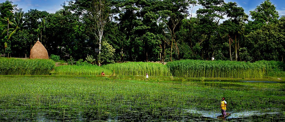
Researchers cite the Sundarbans, the world’s largest mangrove delta, as an example. The region, which is shared between India and Bangladesh, spans approximately 10,000 square kilometres and is one of the world’s most dynamic yet data-poor aquatic regions.
Satellite data can show how coastlines are changing and where flooding occurs. However, many of the changes that are crucial to the people living there take place on a much smaller scale in terms of both geography and time.
Local residents can monitor first-hand factors such as how salt water intrudes into ponds and water reservoirs, how far the tidal waters reach and how the availability of water and other aquatic resources changes. However, there is a risk of such knowledge being lost when water issues are primarily described using large-scale, quantitative data.
“Data is not neutral. Someone decides what to measure, how to measure it and what knowledge is considered relevant. This, in turn, influences which problems we identify and which solutions we choose,” says Giuliano Di Baldassarre.
From more data to better data
Researchers therefore argue that future water monitoring must involve more than simply making data open and accessible. Local communities also need to be able to contribute to how data is collected, interpreted and used.
This does not mean that satellites and AI are the problem. Quite the contrary – technology can become a very powerful tool for understanding and managing future water crises if it is combined with local knowledge and broader participation.
Researchers are therefore calling for three changes:
- equitable access to high-quality data,
- genuine participation in how data is produced and interpreted, and
- a broader view of who possesses knowledge and expertise regarding water.
“If we succeed in combining the new technology with local and experience-based knowledge, AI and Earth observation can contribute to a more sustainable water future. But if we do not change how data is produced and who has a say in the matter, the new data revolution may instead exacerbate existing inequalities,” says Giuliano Di Baldassarre.
Malin Eivergård
Publication
Giuliano Di Baldassarre, Luigia Brandimarte, Mariana Madruga de Brito, Jenia Mukherjee, Maria Rusca: Towards equitable hydrological data in the age of Earth observations and artificial intelligence, Nature Water (2026)